
Walk a Suwanee Street by Address
A sound Suwanee street directory search moves from the map to the records, not from a name to a guess. The county property roll identifies the parcel and taxpayer. Gwinnett GIS shows nearby lots and the city boundary. A deed then proves a transfer of legal ownership. None of those records, alone, proves every person who occupies the home. Use each source for the fact it was built to record.
- Enter the full address in the Gwinnett property search. Copy the PIN, owner spelling, situs address, mailing address, lot, subdivision, legal description, and deed reference.
- Open the GIS Data Browser, select Street Search, and zoom until parcel lines appear. Use Identify on the target and each nearby lot.
- Confirm whether the parcel is inside Suwanee. A postal Suwanee address may instead be in unincorporated Gwinnett or Forsyth County.
- Use the current deed reference in GSCCCA or visit the clerk counter. Match the legal description before linking a party to the parcel.
- For past occupants, consult the Suwanee-inclusive directory years and census or newspaper sources. Do not treat the owner list as a household list.
Search Suwanee Property Fields
The Gwinnett property and GIS tools support several ways into a Suwanee street directory query. Autocomplete fields require selection of the offered match. This matters when a street name has more than one valid form. Address and street searches locate land, while owner and parcel searches recover a known record.
| Search field | Use | Format note |
|---|---|---|
| Address / Parcel Address | Find one physical site | Select an autocomplete result |
| Street | Browse a named segment | Inspect parcels one by one |
| Parcel ID | Return to one stable parcel | May appear like 5143 256 or with an R prefix |
| Subdivision Name | Group platted lots | Not the same as a social neighborhood |
| Property Owner | Find parcels under a recorded name | Ownership does not prove occupancy |
| Intersection | Orient a street section | Then zoom to parcel boundaries |
Other captured fields include condo parcel, zoning case and type, assessment neighborhood, right-of-way project, school, and utility identifiers. The viewer provides layers, a legend, Identify, measuring, bookmarks, sharing, printing, labels, transparency, and zoom. Recent county notices say some owner, sales, and building details moved from map popups to linked assessor detail.
Suwanee Situs and Mailing Addresses
Two address fields answer two different questions. The situs address is where the parcel sits. The mailing address is where the tax office sends correspondence. A mismatch can point to an entity, trust, estate, owner who receives mail elsewhere, or a simple mailing choice. Even a match, paired with an exemption, is supporting evidence rather than a complete list of residents.
- Parcel
- A mapped unit of land with a county identification number.
- Situs address
- The physical location assigned to the parcel.
- Plat
- A recorded map that defines lots, boundaries, and subdivisions.
- Criss-cross directory
- A directory arranged by street and house number instead of only by surname.
Save both addresses in separate notes. Combining them is one of the quickest ways to turn a Suwanee street lookup into a false occupancy claim.
Suwanee Street Directory Record Set
No single Suwanee street directory is complete. The strongest answer comes from a set of records with different keepers and limits. Current property evidence is online, deeds are indexed by party rather than street, and historical occupant evidence is held mainly in library and society collections.
| Record Set | Keeper | What It Shows | Access |
|---|---|---|---|
| Property and tax roll | Gwinnett Tax Assessor | Owner, situs, mailing address, PIN, values, exemption, deed clues | Free property search |
| GIS parcel map | Gwinnett GIS | Parcel shape, street, zoning, ZIP, districts, nearby lots | Free viewer |
| Deeds, liens, and plats | Clerk of Superior Court / GSCCCA | Transfers, parties, book-page or instrument, legal land identity | Counter viewing free; online terms vary |
| Voter records | Georgia election officials | Lawfully released registered-elector address data | Geographic files; MVP is individual only |
| Permits | Suwanee or county custodian | Address, work, issue date, project, and named primary person | Portal or records request; coverage varies |
The PIN links map and tax data. The legal description and recorded reference then link the parcel to deeds and plats. Preserve those identifiers, since postal wording can change while the land stays the same.
Connect Suwanee Streets to Deeds
The deed index is not a street directory. Begin with the current deed reference from the assessor, then use the owner as a grantee, the party receiving property, in the GSCCCA real-estate search. Copy the grantor, recording date, instrument or book and page, and legal description. The next backward search uses that grantor as an earlier grantee.
The Gwinnett deed and land-record page explains the clerk channel shown in this successful capture.
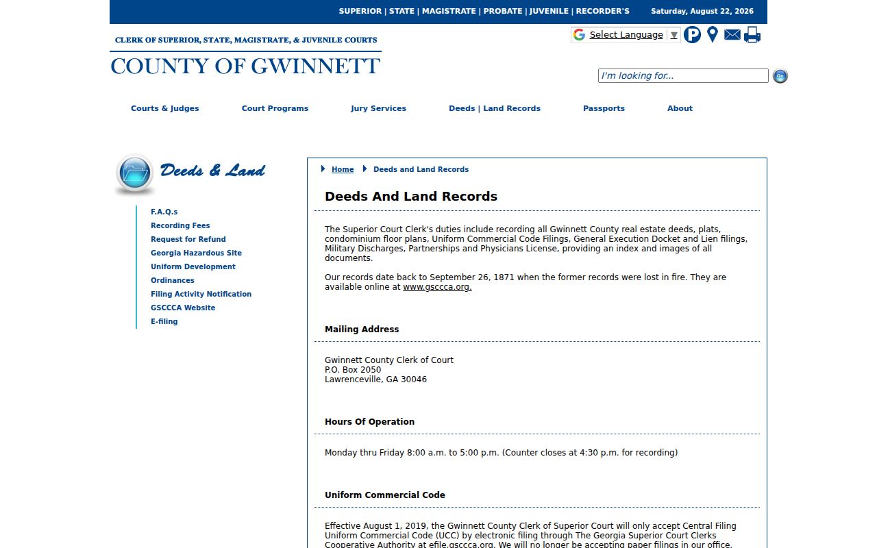
Surviving Gwinnett land records begin September 26, 1871. Counter viewing is free. Copies cost $2.50 for the first page and $1 for each added page, while large plats cost $10.
Note: The clerk's 4:30 p.m. recording-counter close is earlier than the office's 5 p.m. weekday closing time.
Suwanee Permits by Street Address
Permits can add dated evidence about work at an address inside Suwanee. The city's current BSA system covers municipal planning and inspection records, but its start date is not stated in the research. County records apply outside city limits. An archived Gwinnett permit report from 2005 shows the kind of fields that may exist: case number, issue date, address, work description, project, primary person, subdivision, zoning, cost, area, and parcel number.
When an online result is absent, submit a focused request through the Suwanee open-records route or the correct county office. Describe the address, record type, and date span. Under the Georgia Open Records Act, the custodian generally must produce records or state the timetable, cost, and exemption within three business days.
The request should ask for existing records, not require staff to research a household or create a new street list. State whether electronic copies will work, and ask for a cost estimate if the date range is broad. Georgia gives the first 15 minutes of search, retrieval, and redaction work without labor charge. Later labor uses the lowest-paid qualified employee, while ordinary paper copies are generally capped at ten cents per page. These rules make a narrow address and known time span far more useful than a request for every person linked to a long road.
Check Suwanee City Limits First
A Suwanee mailing line does not settle jurisdiction. ZIP 30024 reaches well beyond the incorporated city and into nearby territory, including some Forsyth County addresses. Nearby 30097 is postal Duluth. Use the city map page and county GIS to test the parcel before asking City Hall for permits, court, police, or planning files.
Geography matters. Annexation can change city services without changing a ZIP code, so the parcel boundary controls the office choice.
Suwanee's plan documents annexation of North Gwinnett High School and industrial acres along Satellite Boulevard. That is why a street may cross more than one records jurisdiction while retaining familiar postal wording.
The city boundary also changes which court or permit system should contain an address. Suwanee Municipal Court handles traffic and ordinance matters within its jurisdiction, while citations outside the city can route to Gwinnett Recorder's Court. City building records cover work regulated by Suwanee; the county is the fallback elsewhere in Gwinnett. Save a map view or parcel PIN with the request. It gives the custodian a clearer location than a postal city alone and helps explain why two homes on the same long road may have records in different systems.
Older Suwanee Addresses by Street
Historical address work shifts from current portals to physical collections. The Gwinnett Historical Society catalog confirms Suwanee-inclusive directories for 1974, 1976, 1980, 1983, and 1985. Whether each volume has a reverse street section must be checked onsite. When it does, a house number may lead to a listed householder even when the surname is unknown.
The Gwinnett County Public Library microfilm service adds newspapers and census film between directory years. The collection can be printed, saved to a thumb drive, or emailed, and staff offer research and obituary help. Collection details belong on the Suwanee city directory page; here, the key is to carry the exact street form and parcel identity into the older source.
Suwanee's 1923 Sanborn map offers another address layer because it depicts every structure in the small town then in existence. Do not force a modern house number onto the old sheet. Compare the building position, street, lot, nearby landmark, legal description, and later deed chain. The 1881 Main Street fire destroyed all stores but one, so a business may vanish from the street record even when county deed evidence survives. That local fire is distinct from the 1871 Gwinnett courthouse fire that damaged earlier county land books.
The 1890 federal census is unavailable, but the Gwinnett tax digest from that year can bridge a landowner through land-lot references. Later census schedules, directories, newspapers, and plats can then test whether the same family stayed near the parcel. This layered method is slower than a current street search, but it preserves the difference between a named owner, a listed householder, and every person who may have occupied the building.
Limits of Suwanee Street Records
A current tax owner may not live at the property. Renters and other household members are not indexed in the parcel roll. Utility and delivery customer lists are not public address-directory sources, and driver-address data is closed under federal law. Georgia's My Voter Page verifies one person's own registration details; it is not a public tool for browsing a street. VoteSafe also protects qualifying voter addresses.
Official records are narrower than commercial neighbor products but have a named custodian, a defined purpose, and a correction path. Treat every match as a record about a parcel, filing, or registrant, not as proof of a complete household.
A failed portal search can also reflect spelling, a cross-jurisdiction street, incomplete date coverage, or a protected field. Return to the PIN and legal description, check the city boundary, and contact the office that created the record. A focused Georgia Open Records Act request should name an existing record and a date span. The agency need not build a new resident list or answer a research question.
Lawful use. Suwanee address records are for lawful personal research, civic review, and family or property history. Never use them to stalk, harass, intimidate, or harm anyone.